Drohnenfotografie für Immobilien: Foto & Video 2026
Aug 9, 2026 · 11 Min. Lesezeit
Drohnenfotografie für Immobilien: wann Luftaufnahmen verkaufen, FAA-Part-107-Basics, beste Drohnen je Budget und die Bepreisung als 75-300 € Zusatzleistung.
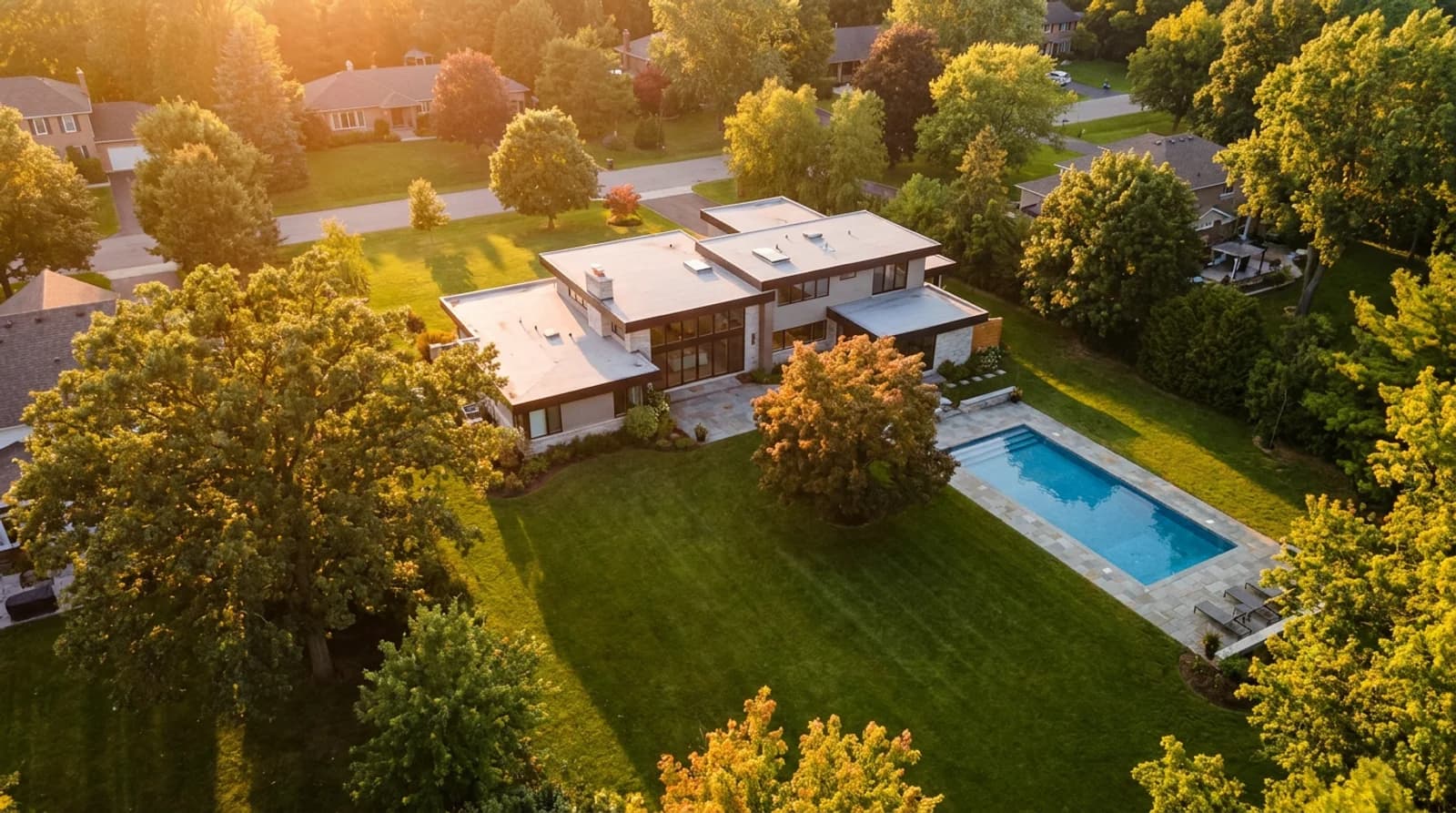
Drohnenaufnahmen für Immobilien lohnen sich, wenn Grundstücksgröße, Wasserlage, Fläche oder die Umgebung Teil dessen sind, was verkauft wird, und lassen sich meist weglassen bei einem typischen Vorstadthaus auf rund 1.000 m², wo die Luftaufnahme nichts zeigt, was ein Bodenfoto nicht schon sagt. Dieser Leitfaden erklärt, wann Drohnenvideo und -fotos für Immobilien ihren Preis wert sind, was FAA Part 107 tatsächlich verlangt, welche Drohne bei welchem Budget sinnvoll ist, und wie Sie Luftaufnahmen als Zusatzleistung statt als Lockangebot bepreisen.
Wann Luftaufnahmen ein Inserat wirklich verkaufen
Einsatzfälle für Drohnenfotografie bei Immobilien lassen sich sauber in zwei Gruppen teilen: „das verändert die Kaufentscheidung“ und „ein nettes Foto, das niemand gebraucht hat“. Der Upsell gehört in die erste Gruppe.
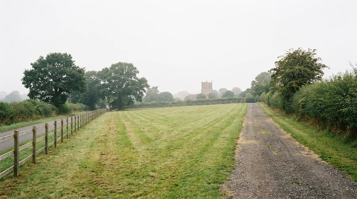
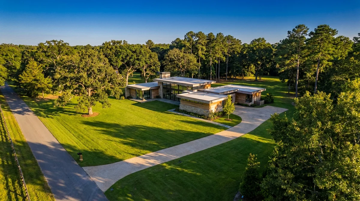
Grundstücksgröße und Fläche. Ein Bodenfoto kann nicht vermitteln, dass ein Haus auf 8.000 statt 800 Quadratmetern steht. Eine Luftaufnahme, die die gesamte Grundstücksgrenze, Nebengebäude und offenes Land zeigt, ist bei einem ländlichen oder stadtfernen Inserat oft das überzeugendste Bild überhaupt.
Wasserlage und Wasserzugang. Objekte am See, Fluss oder an der Küste leben davon, das Verhältnis zum Wasser zu zeigen: wie weit der Steg vom Haus entfernt ist, ob das Ufer privat ist, wie das Grundstück zum Gewässer liegt. Das ist ein Problem, das nur eine Kamera von oben lösen kann.
Häuser am Golfplatz oder in Resort-Nähe. Käufer, die für die Lage am Fairway oder die Nähe zum Resort einen Aufpreis zahlen, wollen das auch sehen. Eine Orbit-Aufnahme, die das Haus vor dem Fairway zeigt, verkauft mehr als jede Bildunterschrift.
Neubauprojekte und geplante Wohnanlagen. Bauträger und Entwickler nutzen Luftaufnahmen, um ein Grundstück im Kontext der gesamten Anlage zu zeigen: Nähe zum Clubhaus, zu einem Grünstreifen oder zu einer zweiten Bauphase, die bald hinter anderen Häusern verschwindet.
Außenansichten mit komplexen Dachformen oder großer Grundfläche. Weitläufige Bungalows, Anwesen und alles, bei dem die Dachform selbst ein Verkaufsargument ist (Solaranlagen, mehrere Flügel, ein Pool-Haus), wirkt von oben besser als vom Gehweg aus.
Umgebungskontext für auswärtige Käufer oder Umzügler. Eine kurze Aufstiegsaufnahme, die Straße, nahe Annehmlichkeiten und die allgemeine Lage zeigt, hilft einem Käufer, der aus einem anderen Bundesland zuzieht, sich zu orientieren. Das schaffen zehn Innenaufnahmen nicht.
Dem gegenüber stehen die Fälle, in denen Drohnenarbeit eher aufgeblähte Abrechnung ist: ein Reihenhaus mit gemeinsamer Wand, eine Eigentumswohnung ohne Außenbereich, ein Einsteigerhaus auf einem Standardgrundstück, flankiert von identischen Häusern. Die Luftaufnahme beweist dort nur, dass das Haus ein Dach hat.
FAA Part 107 einfach erklärt
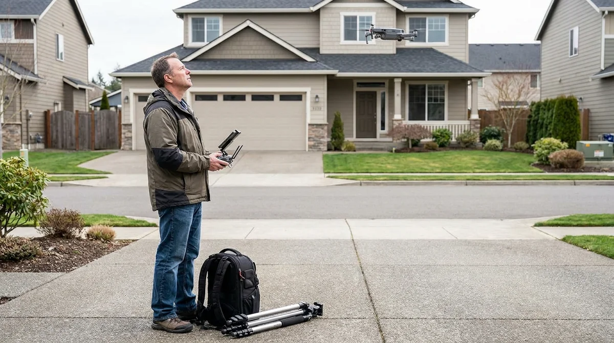
Die rechtliche Frage kommt in fast jedem Gespräch über Immobilien-Drohnenvideo auf, und die Antwort ist einfach: Fließt Geld für den Flug, gelten die Freizeitregeln der FAA nicht mehr. Sie brauchen ein Remote Pilot Certificate nach Part 107.
Das steckt konkret dahinter:
- Das Fluggerät registrieren. Jede Drohne für kommerzielle Arbeit muss unabhängig vom Gewicht bei der FAA registriert werden. Die 250-Gramm-Ausnahme gilt nur für rein private Flüge, nicht für bezahlte Arbeit. Die Registrierung kostet $5 und gilt drei Jahre.
- Den Aeronautical Knowledge Test bestehen. Eine 60-Fragen-Prüfung zu Luftraumklassen, Wetter, Drohnenvorschriften und Notfallverfahren, abgelegt an einem zugelassenen Testcenter für etwa $175. Zum Bestehen brauchen Sie mindestens 70 %.
- Das Zertifikat über IACRA beantragen. Nach bestandener Prüfung reichen Sie den Antrag über das Online-System der FAA (IACRA) ein und erhalten Ihr Remote Pilot Certificate.
- Alle 24 Monate die Auffrischungsschulung absolvieren. Keine erneute Prüfung nötig: Die FAA bietet einen kostenlosen Online-Kurs, mit dem Sie Ihr Zertifikat aktuell halten.
Sobald Sie zertifiziert sind, sind die Betriebsregeln im Alltag einfach: fliegen Sie unter 400 Fuß (rund 120 Metern) über Grund, behalten Sie die Drohne in Sichtweite, fliegen Sie tagsüber oder in der bürgerlichen Dämmerung mit Anti-Kollisions-Beleuchtung, und halten Sie Abstand zu Personen, die nicht am Einsatz beteiligt sind, sofern Sie keine Ausnahmegenehmigung besitzen. Flüge in kontrolliertem Luftraum nahe einem Flughafen brauchen eine Freigabe über das LAANC-System der FAA, die über eine zugelassene App meist innerhalb von Minuten erteilt wird.
Der ganze Prozess dauert in der Regel ein paar Wochen Lernzeit und einen Prüfungstermin: ein Rundungsfehler im Vergleich zu den Bußgeldern, die ein unlizenzierter kommerzieller Flug nach sich ziehen kann, und der Unterschied zwischen legitimer Drohnenarbeit und der Hoffnung, dass niemand nachfragt.
Die besten Drohnen für Immobilienfotografie nach Budget
Für ein gutes Immobilien-Shooting brauchen Sie keine Kino-Ausrüstung. Hier eine realistische Übersicht, was ein arbeitender Fotograf in jeder Preisklasse wirklich braucht.
| Budget-Stufe | Drohne | Straßenpreis | Geeignet für |
|---|---|---|---|
| Einsteiger (700-900 €) | DJI Mini 4 Pro | ca. 759 € | Für gelegentliche Luftaufnahmen; starke 4K-Fotos und -Videos in einem Gehäuse unter 250 Gramm |
| Sweet Spot (1.000-1.400 €) | DJI Air 3 | ca. 1.099-1.349 € | Doppelkamera mit Weitwinkel und Tele, besserer Dynamikumfang; die richtige Wahl, sobald Drohnenarbeit regelmäßig auf der Rechnung steht |
| Premium (2.200-3.400 €) | DJI Mavic 3 Pro | ca. 2.199-3.389 € | Dreifachkamera mit größerem Sensor und satteren Farben, für Fotografen, die Drohne als Top-Paket verkaufen |
| Kino-Klasse (ab 5.000 €) | DJI Inspire 3 | ab 5.000 € | Hochwertige Videoproduktion für Luxusimmobilien und spezialisierte Immobilien-Videografen |
Für die meisten Immobilienfotografen, die Drohne als Nebenleistung anbieten, reichen Mini 4 Pro oder Air 3 völlig aus. Der Sprung zu einer Drohne der Mavic-Klasse lohnt sich erst, wenn Luftaufnahmen so häufig gebucht werden, dass schärfere Fotos und Videos spürbar anheben, was Sie verlangen können.
Drohnenarbeit als Zusatzleistung bepreisen
Der Fehler, den viele Fotografen bei Drohnenfotografie für Immobilien machen, ist, sie als eigenständiges Produkt mit eigener Buchung und Rechnung zu behandeln. So bepreist, konkurriert das Angebot mit jedem Drohnenpiloten am Markt allein über den Preis. Als Zusatzleistung zu einem Shooting, das ohnehin schon gebucht ist, hat es dagegen keine Konkurrenz: Der Makler telefoniert bereits mit Ihnen.
| Zusatzleistung | Was Sie berechnen | Ihre Kosten / Aufwand | Warum es sich verkauft |
|---|---|---|---|
| Luft-Fotos (5-10 Bilder) | 75-150 € | 10-15 Min. Flug, einfache Bearbeitung | Zeigt Grundstücksgröße und Lage, die ein Bodenfoto nicht vermitteln kann |
| Luft-Videoclip (30-60 Sek.) | 100-200 € | 15-20 Min. Flug, kurzer Schnitt | Gibt auswärtigen Käufern Kontext zur Umgebung |
| Komplettpaket Luftaufnahmen (Fotos + Video) | 150-300 € | 25-35 Min. vor Ort, kombinierte Bearbeitung | Wirkt wie eine Premium-Marketingstufe, nicht wie eine Extragebühr |
| Eigenständige Drohnenbuchung (ohne Fotopaket) | 150-400 € | separate Anfahrt, komplettes Setup | Selten; meist nur bei großen Grundstücken oder Neubau-Marketing |
Die Rechnung funktioniert wie beim virtuellen Staging: Ihre Grenzkosten sind ein paar Minuten Flugzeit, die ohnehin schon vor Ort anfallen, und der Makler zahlt für das Ergebnis (ein Inserat, das vollständig abgedeckt wirkt), nicht für Ihre Zeit. Wenn Sie eine breitere Preisstruktur aufbauen, zeigt unser Leitfaden zu Preisen für Immobilienfotografie, wie Sie Luftaufnahmen neben Ihren anderen Stufen positionieren, damit sie Ihren durchschnittlichen Auftragswert heben, statt auf einem separaten Preisblatt zu verstauben, das niemand liest. Und da Drohnenarbeit nur eine Zeile auf diesem Menü ist, kombinieren Sie sie mit Zusatzleistungen auf Bodenebene wie RoomLifts Immobilien-Fotobearbeitung: Objekte entfernen, Himmelaustausch und virtuelles Staging machen aus demselben Shooting mehrere weitere abrechenbare Leistungen.
Drohnen-Videosequenzen, die wirklich funktionieren
Die wirkungsvollsten Immobilien-Drohnenvideos sind nicht kreativ, sondern eine kleine Auswahl bewährter Bewegungen, gut ausgeführt. Fünf Muster decken fast jedes Inserat ab:
| Einstellung | Was sie zeigt | Typische Länge |
|---|---|---|
| Die Enthüllungs-Orbit | Langsame 360-Grad-Umkreisung des Hauses, die Objekt und Grundstück einführt | 10-15 Sek. |
| Der Aufstieg | Senkrechter Steigflug von der Haustür aus, der zuerst das Haus und dann die Umgebung zeigt | 8-12 Sek. |
| Der Rückwärts-Abzug | Rückwärtsfahrt vom Eingang aus, die sich von der Haustür zur ganzen Fassade öffnet | 6-10 Sek. |
| Die Traverse | Seitlicher Flug entlang einer Grundstücksgrenze oder Uferlinie, der Ausdehnung und Maßstab zeigt | 10-15 Sek. |
| Das Abstiegs-Finale | Langsamer Sinkflug zur Haustür, der das Video einladend abschließt | 6-8 Sek. |
Eine typische 30-45-sekündige Luftsequenz nutzt zwei oder drei davon, nicht alle fünf: eine Orbit zur Einführung, eine Traverse, wenn Grundstück oder Wasserlage etwas hermachen, und ein Abstieg zum Abschluss. Wer jede Bewegung in einen Clip packt, macht daraus eine Highlight-Reel statt einer Tour.
Sobald die Luftaufnahmen im Kasten sind, kommt der schwierigere Teil: aus rohem Drohnenmaterial und Ihren Innenaufnahmen ein fertiges Video machen, ohne echte Schnittzeit zu buchen. Genau diese Lücke schließt ein Tool wie Compose: Es macht aus Inseratsfotos eine fertige Video-Tour mit Timeline-Editor, Objekttour-Vorlagen, AI-Voiceover und passender Hintergrundmusik, und es kann stehende Innenaufnahmen in sanfte Kamerafahrten verwandeln, sodass nicht nur die Drohne für Bewegung im Video sorgt. Legen Sie Drohnenclips neben die AI-animierten Innenaufnahmen und exportieren Sie im passenden Seitenverhältnis (16:9 für MLS und YouTube, 9:16 für Reels und TikTok, 1:1 oder 4:5 für Feed-Posts) in Minuten statt in den Tagen, die ein dedizierter Schnitt normalerweise braucht.
Haben Sie Drohnenmaterial und Fotos, aber keine Zeit für den Schnitt einer Tour? Erstellen Sie mit Compose in Minuten eine fertige Objekttour.
Stage your first room in 20 seconds. No design skills needed.
Wann sich Drohnenarbeit nicht lohnt
Drohnenfotografie ist kein Upsell für jedes Inserat, und sie dort anzubieten, wo sie nicht passt, verschwendet Flugzeit und schwächt das Argument bei den Objekten, bei denen sie wirklich zählt.
- Kleine Standardgrundstücke ohne etwas Besonderes von oben. Wenn die Luftaufnahme nur ein Dach und eine Grundstücksgrenze zeigen würde, die genauso aussieht wie beim Nachbarn, lassen Sie es weg.
- Reihen- und Doppelhäuser. Reihenhäuser und die meisten Eigentumswohnungen haben kein eigenes Grundstück oder Dach, das sich von oben zeigen lässt.
- Gesperrter oder kontrollierter Luftraum ohne Zeit für die Genehmigung. Objekte in Flughafennähe brauchen unter Umständen eine LAANC-Freigabe, die nicht garantiert am selben Tag kommt; versprechen Sie keine Aufnahme, die Sie rechtlich nicht fristgerecht liefern können.
- Enge Zeitpläne bei einem Inserat mit niedriger Provision. Wenn die zusätzlichen 30 Minuten vor Ort keine nennenswerte Zusatzgebühr einbringen, ist der Zeitdruck es nicht wert.
- Schlechtes Wetter ohne Puffer für eine Wiederholung. Wind und Regen holen die meisten Consumer-Drohnen vom Himmel; verwetten Sie keine Lieferung am selben Tag auf einen Flug, der vielleicht ausfällt.
Dieselbe Logik gilt für jede Zusatzleistung: Sie verdient ihren Platz im Paket, wenn sie verändert, wie ein Käufer die Immobilie wahrnimmt, nicht nur, weil Sie die Ausrüstung besitzen. Einen breiteren Blick darauf, wo Drohne neben anderen margenstarken Leistungen einzuordnen ist, bietet unsere Aufschlüsselung zu AI-Tools für Immobilienfotografen und dazu, ob Immobilienfotografen virtuelles Staging anbieten sollten als ergänzenden Upsell bei den Objekten, bei denen Drohne nicht passt.
Häufig gestellte Fragen
Brauche ich für Immobilien-Drohnenfotografie eine Lizenz?
Ja. Jeder Drohnenflug gegen Bezahlung, auch für Immobilieninserate, braucht ein Remote Pilot Certificate der FAA nach Part 107. Das heißt: das Fluggerät registrieren, einen 60-Fragen-Wissenstest mit mindestens 70 % bestehen und alle 24 Monate eine Auffrischungsschulung absolvieren. Wer ohne Zertifikat für einen zahlenden Kunden fliegt, riskiert Bußgelder, die den Auftragswert um ein Vielfaches übersteigen.
Was kostet Drohnenfotografie für Immobilien?
Als Zusatz zu einem Fotoshooting kosten Drohnenfotos meist 75 € bis 150 €, ein kurzer Luft-Videoclip 100 € bis 200 €, und ein kombiniertes Foto-Video-Paket liegt bei etwa 150 € bis 300 €. Ein eigenständiger Drohnenpilot für ein einzelnes Inserat ohne umfassenderes Fotopaket kostet je nach Markt und Lieferzeit meist 150 € bis 400 €.
Welche Immobilien profitieren am meisten von Drohnenfotografie?
Luftaufnahmen lohnen sich bei Objekten, bei denen Grundstück, Fläche, Wasserlage oder Umgebung Teil des Verkaufs sind: Häuser mit großem Grundstück, ländliche Anwesen und Pferdehöfe, Objekte am Wasser oder am Golfplatz sowie Neubauten, bei denen die umliegende Entwicklung eine Rolle spielt. Ein Vorstadthaus auf rund 1.000 m² ohne etwas Besonderes von oben rechtfertigt den Zusatz selten.
Darf ich für Immobilien ohne Part 107 eine Drohne fliegen?
Nur, wenn Sie für den Flug nie bezahlt werden, was fast jeden professionellen Immobilieneinsatz ausschließt. Die Regeln für Freizeitpiloten gelten nicht mehr, sobald ein Makler, Verkäufer oder Maklerbüro Sie bezahlt oder das Foto in bezahltem Marketing auftaucht. Die FAA behandelt das unabhängig von Drohnengröße oder Flugdauer als kommerziellen Betrieb.
Was ist die beste Drohne für Immobilienfotografie mit kleinem Budget?
Für Einsteiger liefert eine Drohne unter 1.000 € wie die DJI Mini 4 Pro 4K-Aufnahmen und starke Fotos, die für die meisten Wohnimmobilien reichen. Sobald Drohnenarbeit zur regelmäßigen Position auf der Rechnung wird, zahlt sich eine Doppelkamera-Drohne im Bereich von 1.000 € bis 1.500 € innerhalb weniger Aufträge aus, durch schärfere Bilder und schnellere Bearbeitung.
Wie lange dauert ein Immobilien-Drohnenshooting?
Die meisten Drohnen-Zusätze bei Wohnimmobilien dauern 15-30 Minuten vor Ort: ein paar Minuten für Vorflugcheck und Luftraumprüfung, dann 10-20 Minuten Flugzeit für Fotos und einen kurzen Videodurchgang. Die Bearbeitung braucht meist weitere 15-30 Minuten, sodass der Zusatz einen Shooting-Tag selten um mehr als eine Stunde verlängert.
Bereit, Ihre Anzeigen zu transformieren?
Richten Sie Ihren ersten Raum ein in 20 Sekunden. Keine Designkenntnisse nötig.